Kentucky just made headlines with a new project — the Boone County multi-use path contract. At first, it sounds like a simple trail for people to walk and bike on. But behind that news is something bigger that every builder, engineer, and property owner should notice: a growing need for ALTA Land Title Survey services across the state.
This contract might look small, but it’s a sign of what’s coming. Kentucky is investing more in roads, paths, and public spaces — and every one of those projects starts with clear land information.
The News Behind the Project
Boone County leaders recently approved a large plan to build a new multi-use path that connects neighborhoods, schools, and parks. The project will also fix utilities, add stormwater systems, and make crossings safer. To make that happen, the county first needs to know exactly where every property line, easement, and road access is located.
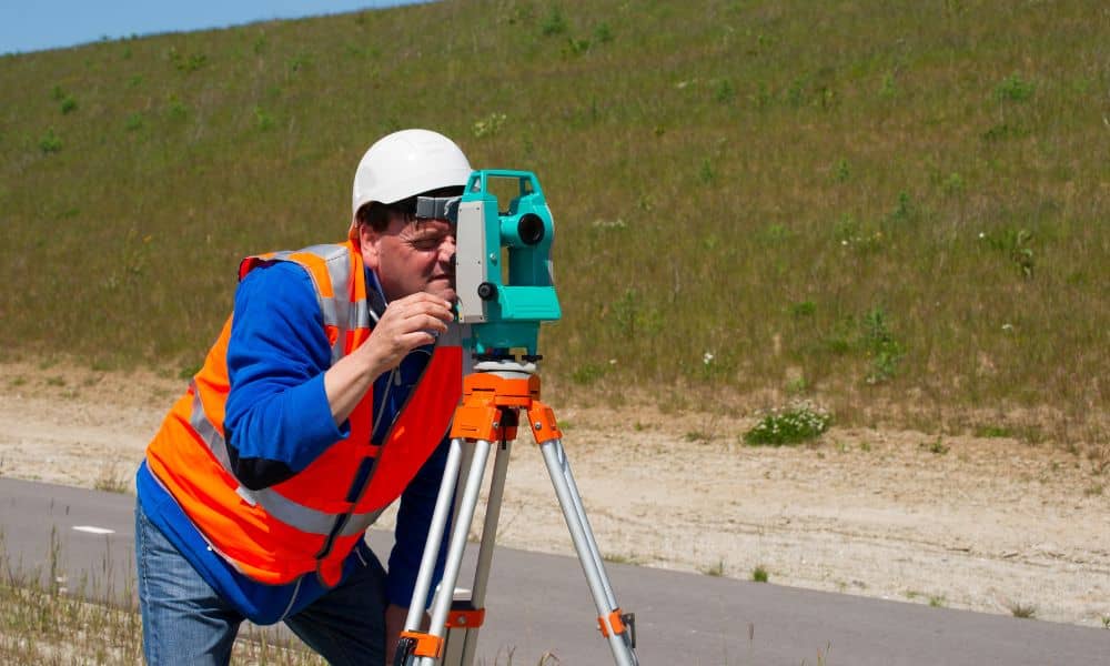
That’s where surveyors come in. Before engineers design anything, a surveyor must map the land and confirm who owns what. An ALTA Land Title Survey gives that full, verified picture. Without it, land disputes or mistakes could delay construction and increase costs before work even starts.
Why Public Works Projects Rely on ALTA Surveys
For public projects, good boundaries aren’t just helpful — they’re required. When a county adds new trails, roads, or water lines, they must make sure all land records match the real world. They also need to confirm that utilities and rights-of-way are in the right place.
An ALTA survey helps them do that. It follows strict national standards made by the American Land Title Association (ALTA) and the National Society of Professional Surveyors (NSPS). That means every map meets a high level of accuracy that government offices and lenders can trust.
In Kentucky, many public works projects use a mix of local, state, and federal funds. Each funding source requires proper land documentation before construction. ALTA-standard surveys help counties prove that everything is in order, reducing the chance of title or ownership problems later on.
Simply put, before anyone starts building, they have to get the land details right.
The Ripple Effect Across Kentucky
One project can start a trend. Once Boone County completes this path, other counties may follow their lead. Each new path, greenway, or public improvement will require surveyors to step in early.
For local surveying firms, that means more opportunities. Cities and counties are planning faster, and they need professionals who can deliver accurate land data that meets ALTA standards. Civil engineers also depend on this information to design safely and legally.
This shift is already visible. Cities like Bowling Green, Owensboro, and Elizabethtown are expanding trails, drainage systems, and roadways. These projects require careful mapping of property limits and public rights-of-way — areas where ALTA surveys play a growing role.
What used to be a tool only for commercial real estate is now becoming essential for public infrastructure too.
What This Means for Bowling Green and Warren County
In Bowling Green, new infrastructure projects are on the horizon. The city is working on greenway extensions and upgrades along the Barren River, as well as flood-control improvements. These projects depend on reliable land records.
Local surveyors who already understand ALTA standards are in the best position to help. Firms that prepare early — by updating tools, training crews, and keeping licenses current — will be ready when new public bids open.
Even property owners and investors can benefit. As new public paths and utilities are built, land near these improvements often rises in value. Before selling or developing, owners should order an ALTA Land Title Survey to confirm boundaries and access. That helps prevent surprises when closing deals or applying for loans.
Getting Ready for the Next Wave
Surveying companies that want to stay ahead need to modernize. Counties now expect accurate digital results and quick turnaround times.
Here’s what forward-thinking firms are doing:
- Using drones and GPS tools. These allow faster, more detailed mapping.
- Partnering with engineering firms. Working together helps them win larger public contracts.
- Training regularly. Staying updated on ALTA and NSPS standards keeps reports compliant.
- Improving data workflows. Faster field-to-office processing means smoother project delivery.
These steps take effort, but they build stronger relationships with local governments and engineering teams — and that can lead to long-term work.
How Developers and Property Professionals Benefit

It’s not just public agencies that gain from this shift. Developers, lenders, and investors can benefit too.
When a city builds a new trail or road, the nearby properties become more valuable and more complex. They might share access points, easements, or utilities with public land. Before construction or financing, those sites often need updated ALTA Land Title Surveys to confirm boundaries and legal access.
For growing areas like Bowling Green, Plano, and Alvaton, this is especially true. Builders who start their surveys early avoid design changes, delays, and rework later on. It’s also a sign to lenders that the project is being handled properly from day one.
Staying Competitive in a Busy Market
As more public projects roll out, competition among surveyors will rise. Firms that respond quickly to requests for bids or pre-qualification notices will stand out.
Accuracy and communication are key. Counties and design teams want surveyors who can explain results clearly and respond fast. When deadlines are tight, reliability is what wins repeat business.
Good survey work isn’t just about collecting data — it’s about helping a project move forward without stress.
Turning Headlines Into Opportunity
The Boone County multi-use path contract may sound like local news, but it’s really a preview of what’s next for Kentucky. Infrastructure investment is growing, and every new public project begins with careful surveying.
For survey firms, this is a chance to expand. For developers and property owners, it’s a reminder that smart planning starts with verified land data.
So if you’re planning to build, buy, or invest near a new corridor, take the first step that every successful project begins with — a professional ALTA Land Title Survey. In a state where growth is moving fast, knowing exactly where you stand makes all the difference.


