Topographic Survey: The 12 Inches That Decide Flooding
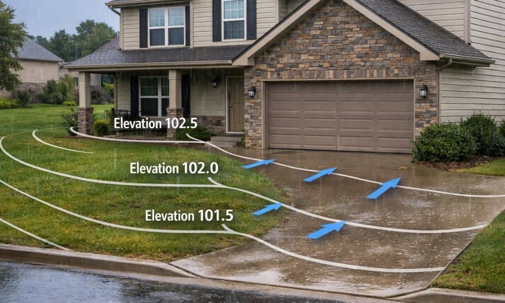
Flood Safety Week always brings the same warning: pay attention to rising water. In Bowling Green, that usually means watching the Barren River, checking weather alerts, and thinking about floodplains. However, most flooding problems don’t start at the river. They start in your yard. In fact, the difference between staying dry and dealing with water […]
Why Property Owners Search “Survey Companies Near Me”

Bowling Green is growing fast. New road projects, traffic updates, and city improvement plans are becoming common topics. Because of this growth, homeowners, builders, and land buyers are paying closer attention to their property. At the same time, more people are typing survey companies near me into Google. This is not a coincidence. It connects […]
Why Industrial Growth Is Raising ALTA Land Survey Needs
Bowling Green is growing fast. New warehouses, factories, and shipping centers keep opening across the area. Because of this growth, more commercial land deals now move quickly. However, faster deals also bring more risk. Buyers and lenders no longer feel safe using only old maps or simple land records. That is why more industrial property […]