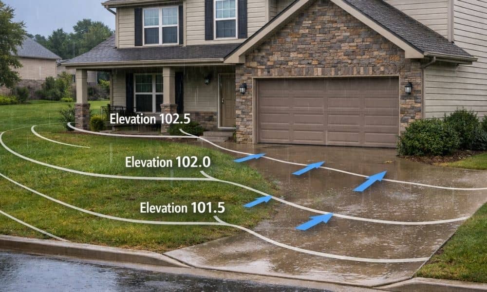
Flood Safety Week always brings the same warning: pay attention to rising water. In Bowling Green, that usually means watching the Barren River, checking weather alerts, and thinking about floodplains. However, most flooding problems don’t start at the river. They start in your yard. In fact, the difference between staying dry and dealing with water damage often comes down to 6 to 12 inches of elevation around your home. That’s why a topographic survey matters more than most homeowners realize.
Flood Risk Is Closer Than You Think
When people hear the word “flood,” they picture homes near major waterways. So if their property sits outside a FEMA flood zone, they assume they’re safe.
Unfortunately, that assumption causes problems.
Many homes in Bowling Green that take on water aren’t anywhere near a mapped floodplain. Instead, they sit slightly lower than the driveway. Or the backyard slopes just enough toward the house to send runoff in the wrong direction. During a fast, heavy storm, water doesn’t care about map boundaries. It follows gravity.
That’s where a topographic survey changes the conversation. Rather than looking at regional risk, it looks at your exact lot and how water will move across it.
The 12 Inches That Decide Everything
Most homeowners don’t know their finished floor elevation. That number tells you how high your interior floor sits compared to sea level. Just as important, it tells you how high or low the surrounding ground sits next to your foundation.
If the soil outside sits only a few inches below your slab, heavy rain can create trouble. Even worse, if parts of your yard sit higher than your finished floor, water naturally drains toward your house.
Now imagine a strong summer storm hitting Bowling Green. Rain falls hard for 30 minutes. Streets collect runoff. Driveways act like small channels. If your garage threshold sits lower than the street by even half a foot, water can push right inside.
Twelve inches may seem small. However, in drainage terms, it’s huge.
A topographic survey measures those differences precisely. It shows where your home sits in relation to the street, the driveway, the patio, and the backyard. Instead of guessing, you see actual elevation numbers.
Subdivisions Change Over Time
Many neighborhoods in Bowling Green were graded years ago. At the time, builders shaped the lots to move water away from homes. Everything likely worked well when the houses were new.
But land never stays exactly the same.
Soil settles. Homeowners add landscaping. Someone installs a new driveway. A neighbor builds a retaining wall. Over time, these small changes shift how water flows between properties.
Because of that, a yard that once drained properly can slowly turn into a low spot. Water might begin pooling near the foundation or collecting near a garage entrance.
A topographic survey captures current elevations, not what the builder intended years ago. That updated information helps you understand how your property functions today.
“Not in a Flood Zone” Doesn’t Mean Protected
Flood maps serve an important purpose. They identify areas at risk from large-scale water events. However, they don’t measure small elevation differences across your front yard.
For example, a flood map won’t tell you if your patio sits slightly higher than your back door. It won’t show that your driveway slopes inward instead of toward the street. It also won’t account for runoff coming from a neighbor’s higher lot.
Surface water causes many everyday flooding issues, especially during intense rain bursts. When storms drop several inches of rain quickly, water flows over land before it has time to soak in. If your home sits in that path—even slightly—you may see repeated problems.
That’s why relying only on floodplain maps leaves a gap. A topographic survey fills that gap with property-specific data.
What a Topographic Survey Actually Reveals
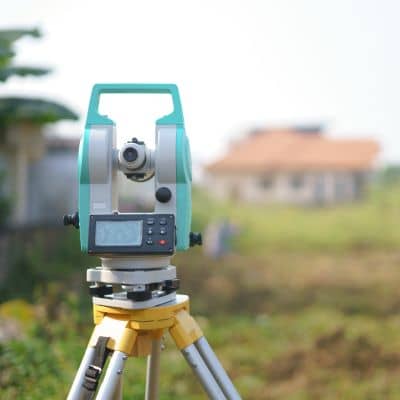
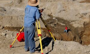
Many people think surveys only mark property lines. In reality, a topographic survey maps the shape of the land itself.
It shows how high your finished floor sits. It measures the slope of your driveway. It captures the elevation of your yard, patio, and surrounding ground. Most importantly, it reveals how all those pieces connect.
Let’s say your backyard slopes toward your crawlspace by a few inches over 25 feet. To your eye, it looks flat. However, during heavy rain, that subtle tilt sends water toward the house. A survey highlights that hidden slope before it turns into mold, moisture, or foundation damage.
Likewise, if your garage floor sits lower than the driveway apron, even by a small margin, runoff can enter during storms. A topographic survey brings that relationship into clear view.
The Real Cost of Ignoring Elevation
Water damage rarely fixes itself. Instead, it grows.
First, you notice damp spots. Then you see staining on drywall or smell mustiness in the crawlspace. Over time, mold develops or flooring warps. Repairs quickly climb into the thousands.
Meanwhile, quick fixes often fail. Adding more mulch, installing small drains, or resealing foundation walls won’t solve a grading issue. Without knowing the elevation differences, you’re guessing.
On the other hand, measuring the land gives you direction. Once you understand how high or low your home sits, you can design a real solution that addresses the root cause.
Flood Safety Week Is a Reminder to Measure, Not Guess
Flood Safety Week encourages preparation. However, preparation should go beyond checking weather apps.
In Bowling Green, small rises and dips shape how water behaves across neighborhoods. Even a gentle slope can redirect runoff from one property to another. Therefore, knowing your exact elevation relationship to surrounding ground becomes powerful information.
A topographic survey doesn’t just create a map. It gives you clarity. It shows whether those critical 12 inches work in your favor—or against you.
Before the next heavy rain rolls through Warren County, take a closer look at your yard. If you’ve ever wondered whether your home sits just a little too low, now is the time to find out.
Because when it comes to flooding, inches matter.