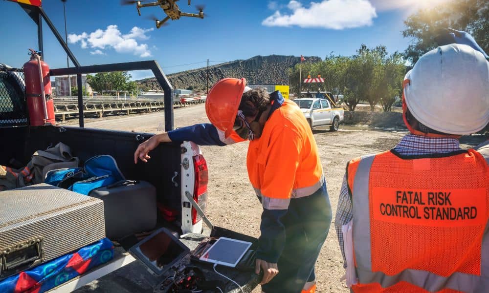
In the last week, surveyors online have been buzzing about a growing problem: drones breaking down with no replacements in sight. One post on Reddit described a surveyor who crashed his Phantom 4 Pro, tried to upgrade to a Mavic 3 Enterprise, and then discovered the drone was on backorder and stuck in customs. He asked the simple question, “What do I fly now?” That frustration speaks to a bigger issue that drone surveyors across Kentucky are starting to feel—equipment shortages that could stall projects if teams aren’t prepared.
This matters to more than just surveyors. When crews can’t get a working drone in the air, property owners, builders, and developers may see delays in their closing dates, site approvals, and construction schedules. In a city like Bowling Green, where growth and new construction are constant, those delays can cost time and money.
Why Survey Drones Are Getting Harder to Find
Drone shortages aren’t just about a crash or broken propellers. They tie into a bigger story happening in the U.S. Over the past year, government officials have raised concerns about data security and foreign-made drones. That spotlight fell on DJI, the company behind many of the drones used for mapping and photogrammetry. In late September, a federal court kept DJI on the Pentagon’s list of “Chinese military companies,” and the Commerce Department is weighing stricter import rules.
For surveyors, this means fewer reliable drones on shelves, longer wait times for shipments, and higher prices for the gear that does get through. If the rules tighten further, Kentucky firms that rely heavily on DJI models could face serious supply problems.
What That Means for Clients
It’s easy to think this is just a tech issue, but the reality hits home for anyone buying, building, or financing property. If a surveyor can’t get a drone in the air, the job doesn’t stop—the project does.
Imagine you’re closing on a piece of land and need an ALTA or boundary survey to finalize the loan. The surveyor’s drone goes down, and the replacement is weeks away. Your closing could get pushed back. Or maybe you’re a builder about to stake out a new subdivision. Without fast aerial data, your grading and layout schedule could fall behind. Even small residential surveys can stall if the team can’t deliver a topographic map on time.
The ripple effect is real: delays lead to rescheduled inspectors, extended permits, and frustrated property owners.
How Drone Surveyors Keep Work Moving

The good news? Professional crews don’t rely on a single piece of equipment. Experienced drone surveyors plan for breakdowns and shortages. Here’s how they keep projects moving:
- Renting or leasing drones from trusted partners when units are out of stock. This option helps bridge the gap during backorders.
- Switching to pole or mast photography paired with GNSS receivers. While not as fast as drones, this still captures high-quality topographic data.
- Bringing in licensed aerial subcontractors who can fly survey-grade drones when the primary crew can’t.
- Scheduling field windows carefully, making the most of clear weather and available staff so data collection stays on track.
These backup strategies may not get as much attention as the drones themselves, but they show the value of working with surveyors who plan for the unexpected.
Choosing the Right Tools for the Job
Another point from that Reddit thread was the worry about buying “just any drone.” Not every UAV can replace a survey-grade rig. Professionals look for very specific features:
- Large sensors for sharper, more accurate images.
- Mechanical shutters to avoid blurring during flights.
- RTK capability for high-accuracy positioning.
- Software compatibility with photogrammetry platforms.
Different projects demand different specs. An ALTA survey for a commercial property needs centimeter-level accuracy. A simple aerial map for a homeowner may only require basic imagery. By matching the right tool to the right job, surveyors keep quality high while avoiding unnecessary delays.
What Clients Should Ask Their Surveyor
If you’re planning a project, you don’t need to know the difference between a Phantom and a Mavic. But you should ask one smart question:
“If your drone goes down, how will you keep my project on schedule?”
A professional surveyor will have a clear answer. They’ll tell you about backup equipment, rental options, or subcontractors they trust. They’ll explain how they can still deliver your survey on time, even if their UAV is sitting in a repair shop. That answer should give you confidence that your project won’t grind to a halt over a missing drone.
Why This Matters More Than Ever
Bowling Green continues to expand, with new neighborhoods, road work, and commercial projects breaking ground every year. That growth relies on accurate surveying. Drones have become essential for mapping, floodplain studies, and construction staking, but the job itself is bigger than the tool.
The Reddit frustrations remind us that even the best equipment can fail. What separates a reliable survey team from the rest is preparation. Do they have a plan B? Do they understand the specs needed for your project? Do they know the local regulations and stormwater rules that shape development here in Kentucky? Those are the details that keep your investment safe.
Final Thoughts
Drone shortages may continue, especially with trade rules still shifting. But that doesn’t mean your survey or project should suffer. In fact, it’s in moments like these that the professionalism of your survey team really shows.
Drone surveyors who think ahead, invest in the right tools, and build strong backup plans can keep projects on track, no matter what happens with supply chains. Whether you’re buying a home, financing a loan, or breaking ground on a new subdivision, choosing a surveyor with that level of readiness makes all the difference.
At the end of the day, drones may be backordered, but your timeline doesn’t have to be.
