How a Construction Surveyor Keeps Multi-Phase Projects Aligned From Start to Finish
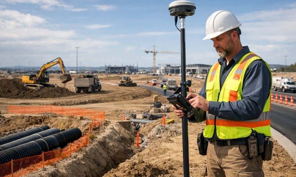
A construction surveyor does more than measure land. On big projects built in stages, they make sure every new phase connects correctly to the last one. Without them, roads end up in the wrong place, pipes miss their targets, and buildings get built off course. For developers managing long projects, knowing how a construction surveyor […]
Why Survey Mapping Matters for Redevelopment Projects
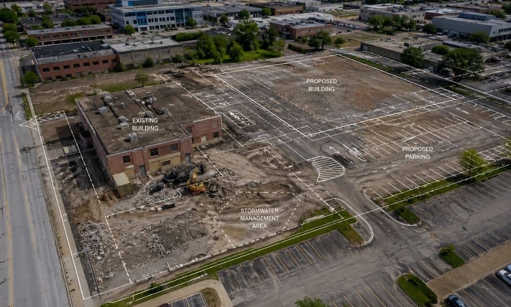
Bowling Green keeps growing. New housing, updated campuses, and refreshed commercial sites keep popping up across the city. Some of these projects sit on land that already has buildings, roads, and years of changes. That’s where things get tricky. A fresh build on open land feels simple. A redevelopment project is not. Old layouts, hidden […]
What LiDAR Mapping Shows That Site Walks Miss
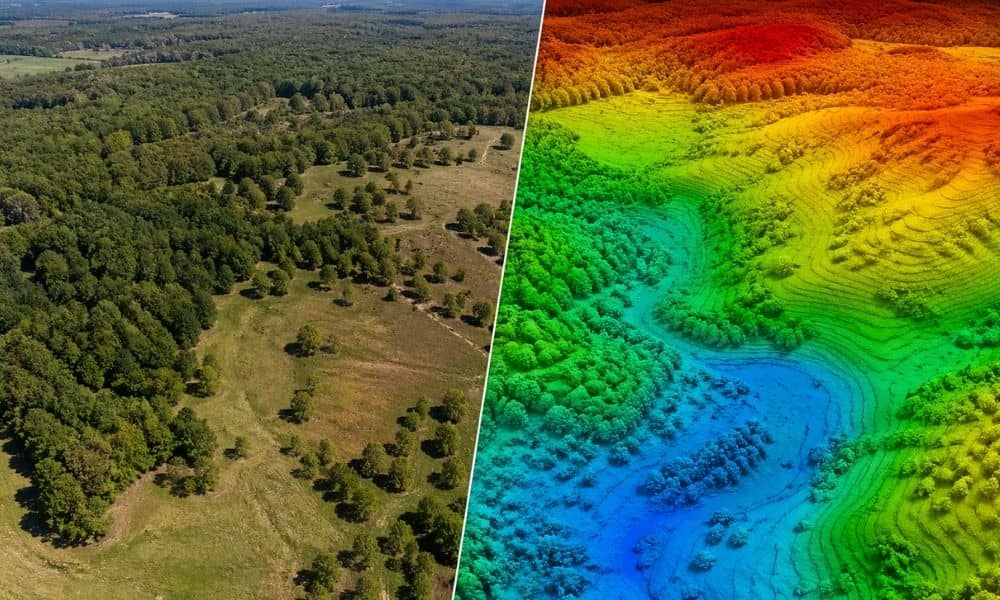
Walk a piece of land and it often looks simple. The ground feels flat. The slope looks gentle. Nothing seems off. Then construction starts. Suddenly, the pad needs more fill than expected. The driveway angle feels awkward. The building site sits lower than planned. Small elevation changes that no one noticed now cost time and […]