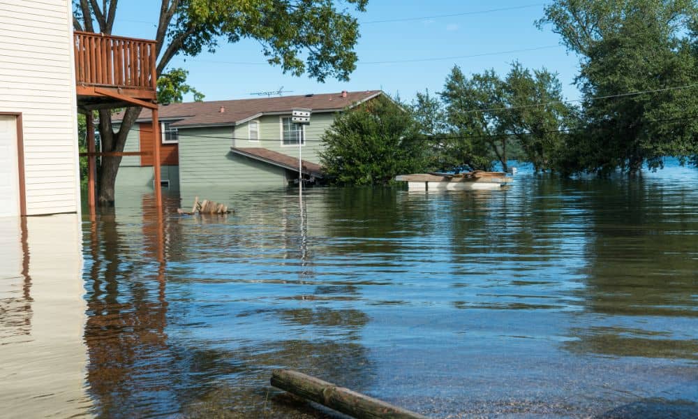
If you’ve tried to buy or refinance a home in Bowling Green lately, you’ve probably heard the term elevation certificate more than once. It’s more than a formality—it’s verified proof of how safely your home stands above potential flood levels. And this week, that proof matters more than ever.
Heavy rain and flood advisories have been all over the news in Warren County, while survey crews are also dealing with another challenge: weak GPS signals caused by a geomagnetic storm. Both events hit at the same time—and together, they can slow down property closings if flood data isn’t verified correctly.
When the Weather and Satellites Don’t Cooperate
This week, NOAA’s Space Weather Prediction Center warned of minor GPS disruptions caused by solar activity. That may sound technical, but for surveyors, it’s a big deal. The GPS signals that help determine elevation points can drift slightly, especially during heavy rain and solar interference.
At the same time, Bowling Green’s local weather station, WBKO, issued flood advisories for parts of the Barren River Basin. When those alerts go out, lenders often slow things down. They want to make sure every flood-related detail in the loan documents is accurate—especially the elevation certificate.
That’s because even small mistakes in elevation can change how FEMA classifies your property. If your home’s elevation turns out to be lower than expected, your flood zone (and insurance requirement) might shift. That can mean extra paperwork, new insurance quotes, or even a delayed mortgage closing.
Why Lenders Suddenly Care So Much
Lenders don’t just want to protect your house—they’re protecting their investment, too. After all, the home acts as collateral for the loan. When flooding is in the forecast, underwriters take no chances.
If a property sits near a mapped flood zone, or if the last flood map update is recent, they’ll often ask for a fresh elevation certificate before final approval. They want to confirm that the survey data matches the newest FEMA base flood elevations and that all measurements were taken under stable conditions.
Think of it as double-checking your height before hopping on a roller coaster—the ride only starts once the numbers look right.
What an Elevation Certificate Proves
An elevation certificate isn’t just about numbers—it’s about reassurance. It shows exactly how high your home sits compared to FEMA’s base flood level.
For homeowners, that means peace of mind. For lenders, it’s proof that the risk is manageable. And for surveyors, it’s the official stamp that their field data meets federal standards.
Right now, that small sheet of paper is the bridge between “ready to close” and “stuck in review.”
What Happens When the Data’s Off
Let’s say your surveyor measured your site during one of those stormy days when GPS reception was spotty. The elevation might come out a few tenths of a foot off. That may not sound like much, but in FEMA’s eyes, it can mean the difference between being inside or outside a flood zone.
If your lender spots a mismatch, they’ll hold your file. The surveyor will need to return, recheck benchmarks, and reissue the certificate. That can push your closing back days—or even weeks—right when you’re supposed to move in.
That’s why experienced crews take extra precautions during stormy weeks. They double-check the KYCORS reference station, verify control benchmarks with a total station, and remeasure vertical data manually when needed. It’s a few extra steps that keep clients from losing valuable time.
The Loan-Closing Crunch

During flood season, survey schedules fill up fast. Between the rain delays and lender rechecks, even small mistakes can snowball. That’s why it’s smart to ask early if your lender needs a current elevation certificate.
Some lenders only accept certificates that are less than a year old. Others require a recheck anytime a flood map is updated or when a property has been improved—like adding fill or extending a foundation.
If you wait until a few days before closing to find out, you might be stuck scrambling for an appointment.
A quick call to your surveyor now can keep everything on track. Many firms offer a “loan-ready packet” that includes your elevation certificate, flood zone map, and benchmark data summary. That packet gives underwriters everything they need in one place—no back-and-forth emails, no missing documents.
How Homeowners Can Stay Ahead
Even if you’re not buying right now, checking your elevation certificate during this kind of weather is a smart move. Flood maps change over time, especially in areas like Bowling Green where karst terrain causes unusual drainage patterns.
If your certificate is outdated, your insurance company might be charging you more than necessary—or worse, not giving you full protection. Getting a new one before renewal season ensures your coverage reflects your actual risk.
For builders and developers, having accurate elevation data early in the project can also prevent future headaches. It helps with grading plans, drainage design, and FEMA compliance if the property will later need a flood certification for sale or refinancing.
Real-World Example
A client in Bowling Green recently contacted us when their lender flagged an old elevation certificate just days before closing. The original survey was done three years ago, using control data that FEMA later updated. After rechecking with our current benchmarks and confirming against the latest flood panel, we found their property sat 0.8 feet higher than listed.
That difference moved them out of the high-risk zone, saving over $900 a year in flood insurance—and letting the loan close on time.
That’s the power of accurate data and good timing.
The Bottom Line
Flood warnings and satellite interference might seem like background noise, but for homeowners, lenders, and surveyors, they’re a reminder that timing and precision matter.
Your elevation certificate isn’t just a form—it’s your safeguard against mortgage delays, insurance surprises, and flood risk confusion.
So before the next storm hits, take a moment to ask: Is my elevation certificate up to date?
If it’s not, don’t wait until closing week. A quick recheck today can save you time, money, and a lot of stress tomorrow.


