When you hire a licensed land surveyor, you expect results that are accurate, reliable, and on time. But what happens when one of the main systems surveyors use—the OPUS (Online Positioning User Service)—suddenly goes down? That’s exactly what happened recently, and surveyors across the country turned to Reddit to vent, troubleshoot, and share emergency solutions.
For anyone outside the profession, OPUS might sound technical, but it’s the backbone of modern surveying. It’s the online system surveyors use to process GPS data collected in the field and convert it into precise coordinates. When OPUS stops working, it’s like having your calculator crash in the middle of a math exam. Projects stall, clients wait, and deadlines feel impossible. But for seasoned professionals, especially those here in Bowling Green, there’s always a way forward.
The Reddit Meltdown That Started It All
Last week, a thread on r/Surveying caught fire. Dozens of surveyors shared the same frustration: OPUS was offline again. Some had static GPS data waiting to process for subdivision plats, while others needed it for loan closing or boundary surveys. One comment summed it up perfectly: “I’ve got three jobs on hold and OPUS is still showing ‘pending.’”
You could feel the tension through the screen. Surveyors depend on OPUS for quick turnaround, especially when verifying control points or checking field accuracy. Without it, entire workflows slow down. But instead of panicking, the community came together to share what really works when the system fails.
That moment of collaboration showed something important: a licensed land surveyor doesn’t rely on a single system. They rely on experience, judgment, and the ability to adapt fast.
When OPUS Stops, the Work Doesn’t
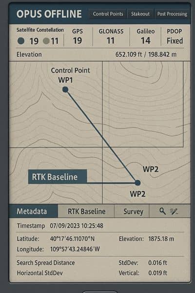
A professional surveyor knows that data accuracy isn’t optional—it’s essential. And when OPUS goes down, there are other tools ready to step in. In the Reddit discussions, a few names kept coming up again and again: NRCAN PPP (from Canada’s Natural Resources agency) and AUSPOS (from Australia’s geoscience department).
These are precise point positioning services, or PPPs. They allow surveyors to upload raw GNSS data and receive coordinates that are nearly as accurate as OPUS results. Sure, the format may differ, but the math behind it is solid. Using these alternatives, surveyors can process their baselines, verify coordinates, and keep moving forward—even when the U.S. pipeline is stalled.
To make the data compatible, many mentioned using the NGS HTDP tool—a free online converter that adjusts coordinates between different datums and epochs (basically, it makes sure all numbers “speak the same language”). With PPP + HTDP, most professionals were back in business within hours.
Why Experience Still Beats Technology
The outage reminded everyone that survey work is about more than gadgets and software. A licensed land surveyor has the training to understand what’s happening behind the numbers. They know how to check for errors, confirm control points, and spot red flags long before those issues reach a client.
Think of it this way: OPUS is like autopilot. It’s fast, efficient, and usually correct. But when it shuts off, you need a pilot who can still fly the plane. In this case, that’s your surveyor—someone who can process the data manually, cross-check results, and guarantee that your property boundaries, elevations, and maps remain accurate.
That’s also why hiring a licensed professional matters. Anyone can run a GPS receiver and hit “submit.” But interpreting that data, especially when systems go offline, takes skill. Licensed surveyors know the equations, the benchmarks, and the local reference points that keep projects consistent even when technology isn’t cooperating.
Real-World Impact: How It Affects Clients
You might be wondering why any of this matters if you’re a property owner, builder, or developer. The answer is simple: timing and trust.
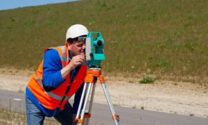
Imagine you’re closing on a property and need a certified boundary or mortgage survey. Every day counts. An OPUS outage could easily delay your survey results—but only if your surveyor isn’t prepared. A reliable, licensed land surveyor plans for disruptions. They already have backup systems, local base point libraries, and old-school total station methods ready to go.
That preparation protects you. It means your loan closing, construction staking, or subdivision plan won’t be held up just because a federal website went offline.
In Bowling Green, for example, surveyors often deal with a mix of open farmland and urban canopy. That variety demands flexibility. When GNSS data looks questionable, experienced surveyors know when to reshoot points, switch to different methods, or double-check results against local benchmarks. The goal is simple: accurate results delivered on schedule, no excuses.
Turning a Frustration Into a Lesson
If there’s one takeaway from the Reddit thread, it’s that professionals help each other adapt. While some users were venting, others were teaching—sharing screenshots, coordinate files, and links to alternative services. It turned into a small masterclass on how to stay productive during downtime.
And for clients, this is actually good news. It means the surveying community is active, connected, and willing to find solutions fast. When you work with a licensed land surveyor, you’re hiring into that network of knowledge. You’re choosing someone who doesn’t just collect data but knows how to troubleshoot, verify, and deliver accurate information no matter what happens behind the scenes.
What This Means for You
If you’re planning to build, buy, or develop land, keep this in mind: survey technology is powerful, but human expertise keeps it dependable.
Ask your surveyor how they handle data processing. Do they rely only on OPUS, or do they use other PPP services as well? Do they maintain their own control libraries? Small questions like these reveal a lot about their professionalism.
A truly skilled licensed land surveyor will tell you, “We’ve got backups for everything.” That’s the kind of confidence you want when property lines, elevations, and budgets are on the line.
So the next time OPUS—or any online system—takes an unexpected break, remember: your project doesn’t have to. The right surveyor will already have a plan in motion.
Final Thought
Outages happen. Websites go down. But solid fieldwork, cross-checking, and professional training never do.
When you hire a licensed land surveyor, you’re not just paying for coordinates—you’re investing in peace of mind. You’re choosing someone who can adapt, solve problems, and keep your project moving even when the digital world throws a curveball.
Because in land surveying, reliability isn’t about waiting for systems to come back online. It’s about knowing your surveyor can keep working without missing a beat.
