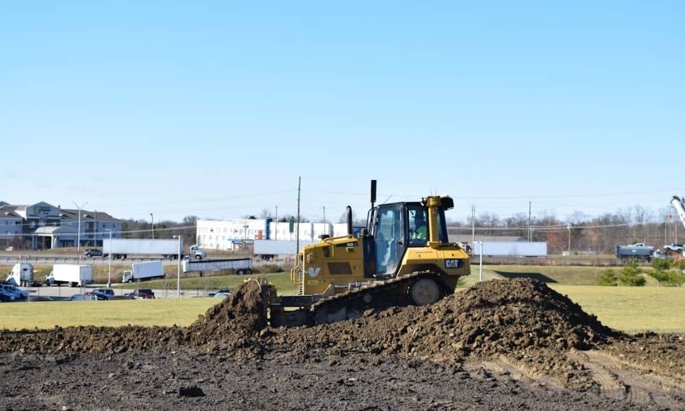
Raising a building pad above the ground around it sounds easy. But if you get it wrong, the water may not drain right. Or the floor height may not meet flood rules. An elevation survey stops these problems before they start. It shows your team exactly how high the ground sits now and how high the pad needs to be.
Bowling Green keeps adding new stores, offices and other commercial buildings. Some of this land has uneven ground and tricky drainage. That makes elevation surveys even more important here.
Why Raised Commercial Building Pads Require Accurate Elevation Data
A raised pad sits higher than the ground around it. Builders raise pads to keep the floor above flood level, to help water drain away from the building, or to match the height needed for loading docks and driveways. None of this works well without good elevation data first.
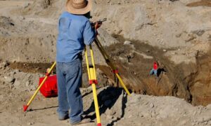
An elevation survey measures the height of the ground at many points across the site. Surveyors then tie those points to a known reference height, called a datum. This lets engineers figure out how much fill dirt is needed, where the edges of the pad will sit, and which way water will flow once the building is there.
Skip this step, or use old data, and the numbers that follow are just guesses. Fill amounts get miscalculated. Drainage slopes end up too flat or too steep. Floor height gets measured from the wrong starting point. Fixing these mistakes after the concrete is poured costs a lot of money.
An elevation survey usually checks:
- The height of the ground across the building area and the site around it
- Heights along property lines, easements and entry points
- The highest and lowest points, which control how water drains
- Reference points tied to a known height standard
This information becomes the base for grading plans, stormwater plans and the pad height itself.
How Elevation Surveys Support Commercial Site Planning Decisions
Every step of site planning depends on elevation data. Architects use it to set the floor height. Engineers use it to design where stormwater goes. Lenders and city reviewers use it to check that the site plan follows the rules.
Without a current elevation survey, teams end up guessing. A developer might think water naturally drains toward the street. Then during permitting, they learn the lowest point is actually right by the front door. Finding this out late usually means redoing the design, and that costs time.
Good elevation data lets your team answer key questions early:
- How much fill dirt the pad will need, and where it should come from
- Where stormwater ponds or basins should go
- How steep the slope can be between the pad and nearby parking or driveways
- Whether the site can meet ADA slope rules at entrances
Bowling Green’s Planning and Zoning Commission, along with the local floodplain office, will want elevation data before a site plan can move forward. Rules can differ based on property type and project size, so check with the city early.
Coordinating Building Pad Grades With Existing Site Conditions
A raised pad does not sit alone. It has to work with the grades on nearby land, the height of the road next to it, the depth of buried utility lines, and any drainage easements crossing the property.
This is where an elevation survey really pays off. Surveyors measure points well beyond the building itself, including spots along shared property lines and existing pipes or lines. This helps engineers see how a raised pad will affect everything around it.
Utility lines sit at fixed depths underground. If a pad is raised too high, it can create problems for sewer lines that rely on gravity to flow downhill. It might also require retaining walls where the ground changes height near the property line. An elevation survey shows the height of existing utilities compared to the planned pad height. This helps engineers spot problems on paper instead of finding them during construction.
Water always needs somewhere to go. If a raised pad blocks the path water currently uses to flow across the site, that water needs a new route. Elevation points measured around the edge of the property show exactly how runoff moves today. That is the starting point for any new drainage plan.
Many commercial properties sit close to karst ground, drainage paths or flood-prone areas. Checking real elevation data, instead of guessing, lowers the risk of a drainage plan that looks fine on paper but fails on site.
Reducing Construction Risks Through Early Elevation Verification
The earlier you catch a problem, the cheaper it is to fix. Elevation mistakes found during design cost time on paper. The same mistakes found during grading or foundation work cost real money, and they can delay the whole schedule.
An elevation survey done before final design lets your team check their assumptions before anything gets built. Here are a few risks it helps avoid:
- Fill settling because the survey missed how much the ground actually varies
- Drainage plans that don’t match the real shape of the land
- Floor heights that fall short of flood or code rules
- Clashes between the planned grade and existing utilities or driveways
For lenders and title companies working on a commercial deal, elevation data also supports their research. A site that needs a lot of fill dirt or grading work carries extra cost and schedule risk. It’s better to know this before closing than after.
Contractors gain from the same checks. When construction staking follows accurate elevation data, the pad gets built to the right height the first time. That means less rework and fewer delays.
Supporting Commercial Development With Precise Elevation Survey Results
A raised commercial building pad is just one piece of a bigger site plan. Elevation survey results feed almost every other part of that plan. Grading design, stormwater plans, ADA rules, utility coordination and floor height all come back to the same set of surveyed points.
For developers, engineers and property owners working through the Bowling Green permitting process, starting with accurate, current elevation data means fewer surprises later. It gives your design team something solid to build on. It also gives city reviewers the information they need to approve a plan without sending it back for more changes.
Survey needs can vary based on property type, project size, lender rules and the local city or county involved. If your timeline depends on permits, financing or a construction start date, check your elevation survey needs with your design team and local officials as early as you can.
Frequently Asked Questions
What is the difference between an elevation survey and a topographic survey?
An elevation survey focuses on ground height at specific points, usually to help figure out pad height, drainage or floor elevation. A topographic survey covers a wider view of the site, including the shape of the land and its features. Many commercial projects use both, and a topographic survey often already includes elevation data for pad design.
How long does an elevation survey take for a commercial site?
It depends on the size of the site, the shape of the land, and how many points need to be measured. A small commercial lot might take just a few days from fieldwork to finished data. Larger or more complex sites take longer. Ask your surveyor about timing early if your schedule is tight.
Do I need an elevation survey if the site already has a topographic survey?
It depends on how old that survey is and whether the site has changed since then. Grading from past construction, erosion or new fill dirt can all change the ground’s height. If the old survey is outdated or the land has changed, a new elevation survey is usually worth getting before final design.