Yes. LiDAR mapping can support karst terrain site planning by showing shallow dips and closed low spots that are hard to see from the ground. It works best as an early planning tool that points your team to the places that need closer study. In Bowling Green, limestone sits under much of the ground, so that early warning can shape where a building, road or pond goes before anyone draws a final plan.
LiDAR also has limits. It records the shape of the ground surface. It doesn’t look inside the rock, and it can’t promise that a site is safe to build on.
Why Karst Terrain Changes Site Planning in Bowling Green
Karst terrain forms where water slowly dissolves limestone and other soluble rock underground. Over time, that process creates sinkholes, sinking streams, springs and caves. Kentucky Geological Survey (KGS) research puts about 55% of the state on rock with karst potential, and Bowling Green sits about 40 miles from Mammoth Cave on that same kind of ground.
Water on a karst site doesn’t always stay on the surface, and that matters for development. Rain that runs into a sinkhole can drop into the rock and travel a long way before it comes back out. A low spot that looks like a good place for a detention pond might sit right over an opening in the bedrock.
The city knows this risk well. A sinkhole opened under the National Corvette Museum in 2014 and swallowed eight cars. Bowling Green later hired a professional geologist to oversee sinkhole repairs and help prevent more damage. For a developer, karst features belong in planning from the first site visit rather than after grading starts.
Reading Subtle Karst Terrain With LiDAR Mapping
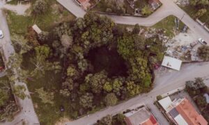
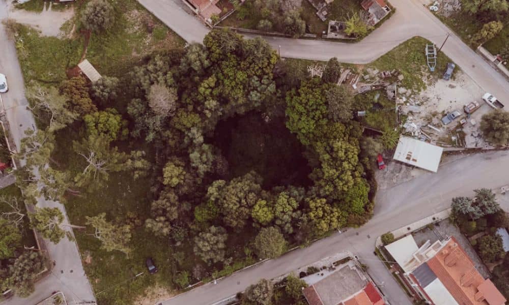
LiDAR builds a detailed elevation model of the bare ground from laser measurements taken by an aircraft or drone. On that model, shallow bowls and closed depressions stand out even when grass, crops or trees hide them. Many sinkholes are wide and gentle, so they don’t look like much from eye level.
Mapping software can compare the elevation model with a copy that has every low spot filled in. The difference between the two highlights closed depressions. These are basins with no surface outlet, and they’re one of the clearest signs of karst.
Kentucky already uses this approach. KGS has used airborne LiDAR to update its sinkhole maps, because the older database came from topographic maps drawn decades ago. Much of that work draws on KYFromAbove, the state’s elevation data program, and KGS reviews the depressions it finds and field-checks some of them.
A project-specific LiDAR flight can capture more detail than a statewide dataset. It can also pick up recent changes, such as a new dip or fill added since the public data was collected. That makes it a good fit for a single development tract.
Combining LiDAR Data With Geologic Site Records
LiDAR shows the shape of the ground but doesn’t explain what that shape means. Pairing the elevation model with geologic records gives the planning team the context it needs. Each source fills a gap the others leave.
KGS publishes a karst groundwater basin map for the Bowling Green 30 x 60 minute quadrangle. KGS built its basin maps mainly from dye-tracing studies, and they help show which spring or basin a site may drain to. The maps work at a regional scale, so they won’t pinpoint every spring or sinking stream on a single parcel.
Other records help too. KGS has published detailed surficial geologic maps for the Bowling Green North and South quadrangles. Its online map service shows LiDAR-derived sinkholes, water wells and springs. Soil maps and nearby geotechnical reports can add more pieces.
When these layers sit on top of the LiDAR model, patterns get easier to read. A row of depressions might follow a mapped rock unit. A dip near a known spring might deserve more attention than one in an upland field.
Flagging Areas That Need Closer Site Investigation
The most useful LiDAR result on a karst site is a short list of places that need a closer look. Each flagged spot should include a note on why it made the list. Common reasons include:
- A closed depression has no surface outlet.
- A depression sits under or near a planned building pad, road or pond.
- Several low spots line up in a row.
- Past grading or fill may have covered an old sinkhole.
- A feature sits close to a mapped spring or sinking stream.
The next step depends on the site and the project. A geologist or geotechnical engineer may recommend field checks, test borings, geophysical surveys or other testing. LiDAR can’t settle those questions alone, because a surface dip can have several causes and some sinkholes leave little trace once someone fills them.
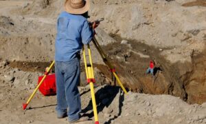
Your surveyor can help here too. Tying each flagged feature to the project’s survey control lets field crews and the geotechnical team find the exact spot later. That keeps everyone working from the same locations.
Where LiDAR Fits Before Grading and Site Design
LiDAR fits best early, before the site plan is set. At that stage, moving a building pad or pond usually costs far less than changing plans after earthwork begins. Early mapping also gives designers time to work around features instead of reacting to them.
A typical order looks like this. The team gathers LiDAR and public karst records, flags features and sends those areas for geologic or geotechnical study. Designers then use the results to place buildings, set grading limits and locate stormwater features.
Local review matters as well. Development and stormwater rules for karst areas can depend on the city, county and state agencies involved, so confirm requirements early with the reviewing office. The LiDAR files can also serve as a starting point for later work, such as a detailed topographic survey or construction staking.
Frequently Asked Questions
Can LiDAR mapping identify sinkholes on a development site?
It can point to likely ones. An elevation model shows surface depressions and other shapes that often go with sinkholes. A dip could also be an old farm pond, a borrow pit or a natural swale, so someone has to review each one before calling it a sinkhole.
Can LiDAR mapping show underground caves?
No. Airborne LiDAR measures the ground surface and anything sitting on it, and it can’t see through soil and rock. Surface clues like sinkholes or sinking streams can hint at openings below, and a geologist may use other methods to study what lies underneath.
Why combine LiDAR mapping with karst groundwater maps?
Surface shape tells only part of the story on karst ground. Water can move underground for long distances and come out at springs well beyond the property line. Groundwater basin maps connect a site to that larger system, which helps engineers plan for runoff and possible spills.