Planning a building, tower, or crane near an airport? You may need an airport height review first. This review checks if your structure could get in the way of aircraft. Aerial surveying can help. It gives you accurate elevation data for your site and your structure.
This matters most to developers, property owners, architects, and engineers working near airports. A crane, a rooftop unit, an antenna, or a tall building can all trigger a height review. It’s best to plan for this early, not at the last minute.
Why Airport Height Reviews Depend on Reliable Site Elevations
A height review compares your structure’s height to the land around it. It also looks at nearby flight paths. This only works if the elevation numbers are correct.
The FAA sets rules for this under Part 77. These rules say when a structure may need a review. It depends on the structure’s height and how close it sits to an airport. The exact rule depends on your site. Check early instead of guessing that your project is fine.
Even a small error in elevation can change the result of a review. A surveyor who only checks a few spots on the ground may miss small changes in the land. This is why aerial data has become useful. It works well on sites with uneven ground or tall trees and buildings.
How Aerial Surveying Maps Terrain Around Proposed Structures
Aerial surveying uses drones with cameras or laser sensors. These tools collect elevation data from above. One flight can cover thousands of points across a whole site.
For a height review, this means a surveyor can build a detailed map. The map shows the exact ground height where your structure will sit. It also shows nearby trees, buildings, and other tall features. This helps on sites where the ground isn’t flat. It also helps when nearby structures are already close to a height limit.
The survey team ties this data to known elevation points. This gives the numbers the accuracy an FAA form needs. Aerial surveys also move faster than ground surveys on large sites. That can help keep your project on schedule.
Where Survey Data Fits Into FAA Obstruction Evaluation
Some structures must go through the FAA’s Obstruction Evaluation and Airport Airspace Analysis process. Most people call this OE/AAA. This review checks your structure’s height and exact location. It looks at how your structure relates to nearby airspace used by planes.
Survey data supports this process. It gives the exact position and height of your structure, tied to the right reference system. Sending in correct numbers from the start can help you avoid delays. Rough guesses often cause those delays.
Check with your surveyor, architect, or the airport to see if your project needs this review. The rules can change based on your structure type, height, and location. A surveyor who has worked on airport projects before can help you plan ahead.
When Ground Control Strengthens Aerial Height Data
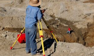
Aerial surveys cover large areas fast. But they work best with ground control points too. These are fixed spots on the ground. A surveyor measures them by hand with normal survey tools.
Ground control checks that the elevations from the air are correct. It also ties them to the right benchmarks. It doesn’t rely only on the drone’s built-in GPS. This extra check matters when your height review needs exact numbers.
A surveyor sets up several ground points before the drone flight. After the flight, the surveyor uses those points to check the aerial data. This fixes any small errors. You get the wide coverage of an aerial survey and the accuracy of a ground survey.
Using Height Data Earlier in Development Planning
Louisville has a lot of growth near its airport. Because of this, height reviews come up often. Cranes, rooftop units, signs, and tall buildings can all trigger one. Bring in a surveyor early. Do this before your design is final. This gives you time to learn if your project needs FAA review.
Waiting until the permit stage can cause problems. Your structure may turn out too tall without extra review. This can lead to redesigns and delays. Check your height and elevation data during early site planning. This gives your design team a clear picture. It also gives you time to make changes before your schedule is locked in.