Buying land is an exciting step—whether you’re building a new home, planning a business, or investing in property. But before you sign on the dotted line, it’s important to know exactly what you’re buying. That’s where a boundary survey comes in.
Many property buyers skip this step, assuming fences or landmarks are enough to define property lines. Unfortunately, that can lead to costly mistakes. In this article, we’ll explain what a boundary survey is, when you need one, and why it’s such a smart move before any land purchase.
What Is a Boundary Survey?
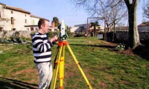
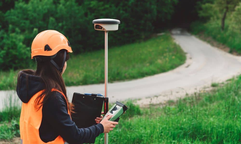
A boundary survey is a type of land survey that determines the exact legal boundaries of a piece of property. Licensed land surveyors use specialized tools—like GPS equipment, measuring instruments, and official property records—to mark where your land begins and ends.
This type of survey usually includes:
- Clearly marked property corners
- A map showing the boundaries and measurements
- Information on fences, buildings, or other features near the lines
The final product is a legal document that defines your land—and can be used for permits, property records, and dispute resolution.
When Is a Boundary Survey Needed?
You may not need a boundary survey for every property purchase, but there are many situations where it’s strongly recommended—or required. These include:
- Buying vacant land with no visible boundary markers
- Disputes with neighbors over fences, trees, or driveways
- Planning to build or fence near the edge of a property
- Unclear property lines on the deed or title
- Mortgage lender requirements (sometimes requested before closing)
If any of these apply to your situation, it’s best to get a boundary survey before buying land to avoid surprises, prevent legal conflicts, and make sure the property lines are exactly where they should be.
What a Boundary Survey Tells You
A boundary survey offers more than just measurements. It provides a clear picture of your property, including:
- The exact dimensions and corners of your land
- Any encroachments, such as a fence or driveway that crosses the line
- Details about easements (for utilities, access roads, etc.)
- Legal access points to the property
All of this information is critical for future use, especially if you’re planning construction or improvements.
How Boundary Surveys Protect Buyers
A boundary survey gives you peace of mind and can prevent major problems down the line. Here’s how it protects you:
- Avoids legal disputes with neighbors about where your land starts and ends
- Prevents building mistakes, like placing a fence or garage on someone else’s land
- Supports title insurance, which covers your legal ownership
- Reveals access or zoning issues before you finalize the deal
In short, it ensures that what you think you’re buying is exactly what’s being sold.
Boundary Survey vs. Other Types of Surveys
Not all surveys are the same. Here’s how a boundary survey compares to other common types:
| Survey Type | Purpose |
| Boundary Survey | Marks legal property lines |
| ALTA Survey | Used in commercial deals; includes title and legal data |
| Topographic Survey | Shows land features and elevation for construction |
| Mortgage Survey | Often used for simple real estate closings; less detailed |
If you’re not sure which one you need, a surveyor can help guide you based on your plans and property type.
How Much Does a Boundary Survey Cost?
The cost of a boundary survey can vary depending on several factors:
- Size and shape of the property
- Terrain (wooded, hilly, etc.)
- Existing property records and deed clarity
- Local surveyor rates
On average, you can expect to pay between $400 and $1,500. Large or complex properties may cost more. It’s a good idea to get a quote before hiring a surveyor.
What to Expect During the Survey Process
Here’s how the boundary survey process typically works:
- Surveyor reviews the deed and title records
- Visit to the property with equipment to take measurements
- Marking property corners with stakes or flags
- Creating a survey drawing or map
- Delivering a final report you can keep or submit for legal purposes
The whole process usually takes a few days to a couple of weeks, depending on property complexity and the surveyor’s schedule.
Who Can Perform a Boundary Survey?
Only a licensed land surveyor can legally perform a boundary survey. Surveyors must be registered and follow state-specific guidelines and codes.
Before hiring someone, check their:
- License status
- Experience with similar properties
- Reputation (reviews, referrals, etc.)
Always request a clear scope of work and timeline up front.
Questions to Ask Before Hiring a Surveyor
To make sure you’re getting accurate and reliable results, ask the following:
- Are you licensed and insured?
- How much experience do you have with boundary surveys?
- Will I receive a map or drawing as part of the report?
- How long will the survey take?
- Do you use modern equipment like GPS or drones?
These questions help you find the right professional for the job.
Final Thoughts
A boundary survey is one of the smartest moves you can make before buying land. It protects your investment, clears up legal questions, and helps you plan ahead with confidence. Whether you’re purchasing vacant land or developed property, a boundary survey ensures you’re buying exactly what’s on paper—and nothing less or more.
Don’t wait until after closing to find out there’s a problem. Know where your boundaries are from the start.
FAQs
1. Do I need a boundary survey for residential property?
It’s not always required, but it’s a smart move—especially if there are unclear lines, old fences, or plans to build.
2. Can I use an old boundary survey?
Only if the land hasn’t changed and the survey reflects current conditions. Many lenders and title companies require an updated version.
3. Is a boundary survey legally required?
Not always, but it may be required by lenders, title insurers, or local zoning rules—especially before construction or development.
4. How long does a boundary survey take?
Typically 1 to 2 weeks, depending on the size and complexity of the property.
5. What happens if there’s a boundary dispute?
A boundary survey can help resolve it by providing legal documentation of property lines.
6. Can a surveyor settle a property line argument?
While surveyors don’t make legal decisions, their report can serve as strong evidence in court or negotiation.
